1847 Canoe Expedition of J. G. Norwood, MD
GO TO REPORT
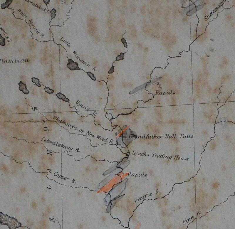
The Tomahawk Area Historical Society owns a map of an important early canoe expedition, authorized by the federal government to survey mineral potential in northern Wisconsin.
This map will be on display in the museum beginning in the summer of 2013.
We have found the report from the leader of the expedition, Joseph Granville Norwood, MD, and have made it available on our site. We have also added explanatory comments.
Aside from being of interest, due to the fact that the Society owns this rare map, there are specific descriptions of the Wisconsin River in the Tomahawk area, 40 years before Tomahawk was founded! Norwood’s report provides delightful insight into what the northern part of Wisconsin Territory was like in these days just before statehood.
Also be sure to visit the museum this summer and see this map in person!
CLICK HERE TO START READING